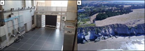
(a) The Caltech CAST outdoor facility, where the vision and control algorithms will be tested. (b) Outcrops of the Monterey Formation near Naples Beach, CA. This site is of interest in studying microbial weathering and will be our primary real-world target.
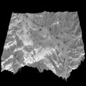
This is a collaborative effort with the Caltech Divisions of Geological and Planetary Sciences (GPS) and Engineering and Applied Sciences (EAS) to enable autonomous, close-in, precision flyby of hard to access geologic features such as cliffs and caves. A UAV will survey one of these inaccessible areas, approaching close enough to enable high fidelity 3D reconstruction from a monocular imager. The reconstructed terrain will be used directly for analysis by the science team but will also serve as part of the control loop to enable subsequent flights to targeted areas of interest. The key technical challenges are in (1) developing a control algorithm to compensate for uncontrolled forcings like wind shear and (2) integrating the vision product into the control algorithm for obstacle avoidance and precision flight.